Best ridden as a shuttled ride, the Whole Enchilada is considered to be one of the best rides in the world, descending 8000 feet from alpine fir and aspen forest down to red rock desert along the mighty Colorado River.
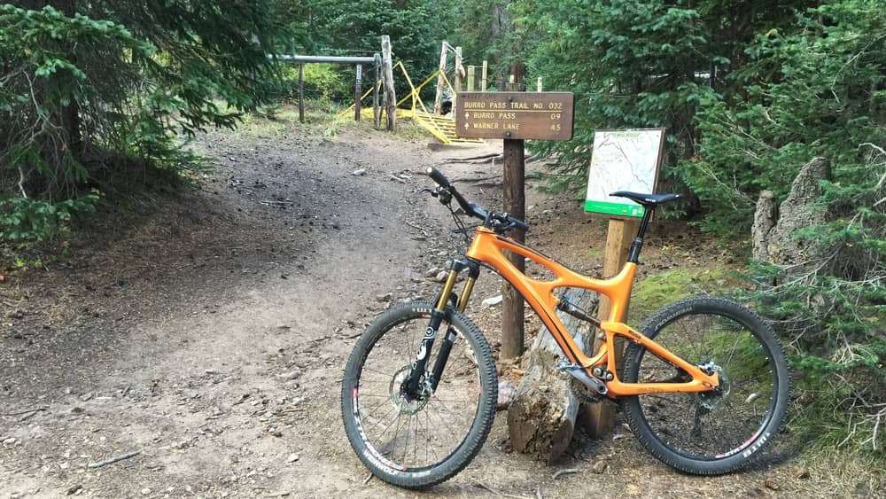
Whole Enchilada: Burro Pass
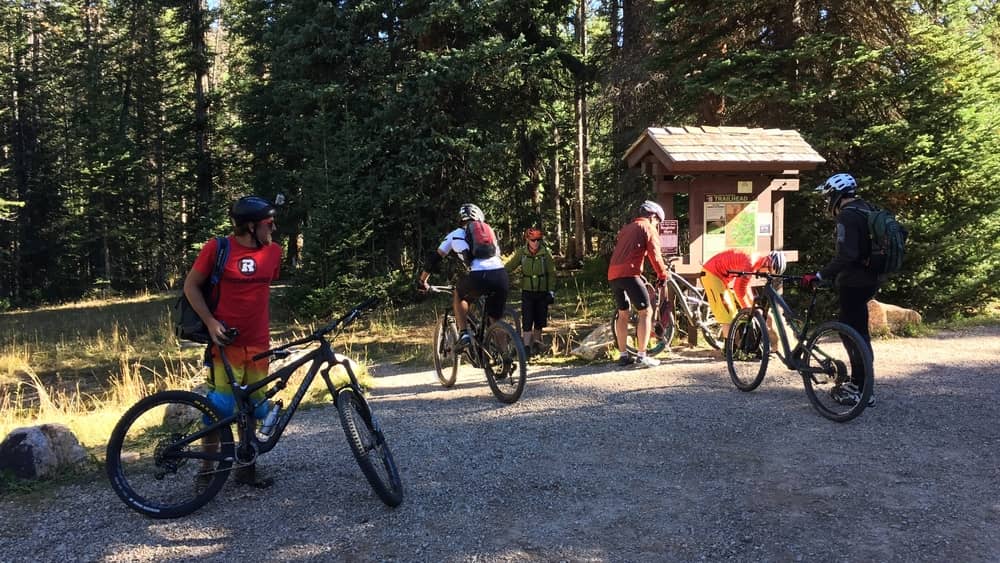
Several shuttle companies in Moab, including Poison Spider and Moab Cyclery, will get you up Geyser Pass Trailhead.
Take the Geyer Pass to Burro Pass trail and then weave through several aspen glades up to Burro Pass.
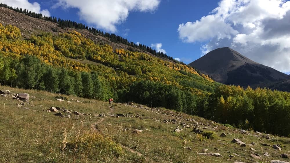
If you ride in the fall, the golden aspens are a real treat.
There’s about 3 miles of climbing from the trail head, but then you get a glorious 25 miles and 8000 feet of descent.

Your initial descent is tight turns on switchbacks through high alpine forest, and you’ll pass over several streams.
Whole Enchilada: Hazard County
There are a few easy climbs and then the singletrack will eventually hit a doubletrack. Follow that road until you pass Warner Lake and arrive at the Hazard County trailhead. This is another popular drop off for the shuttles if Burro Pass is too muddy from snow or rain.
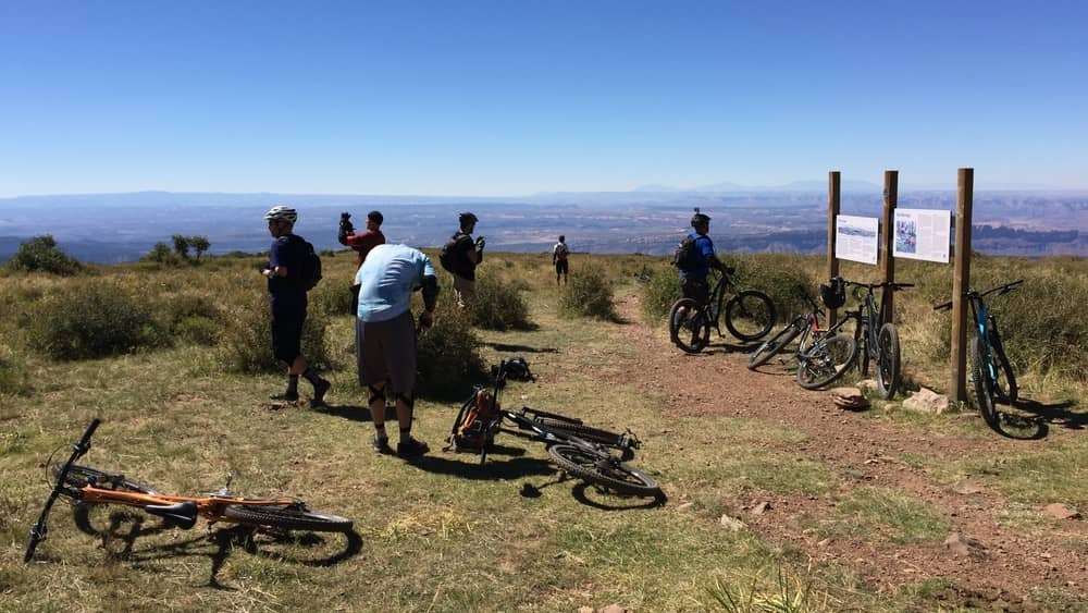
The views from this point really open up. You’ll buzz through lots of oak scrub brush to arrive at the Lasal Mountain Loop Road and see a sign for the Kokopelli.
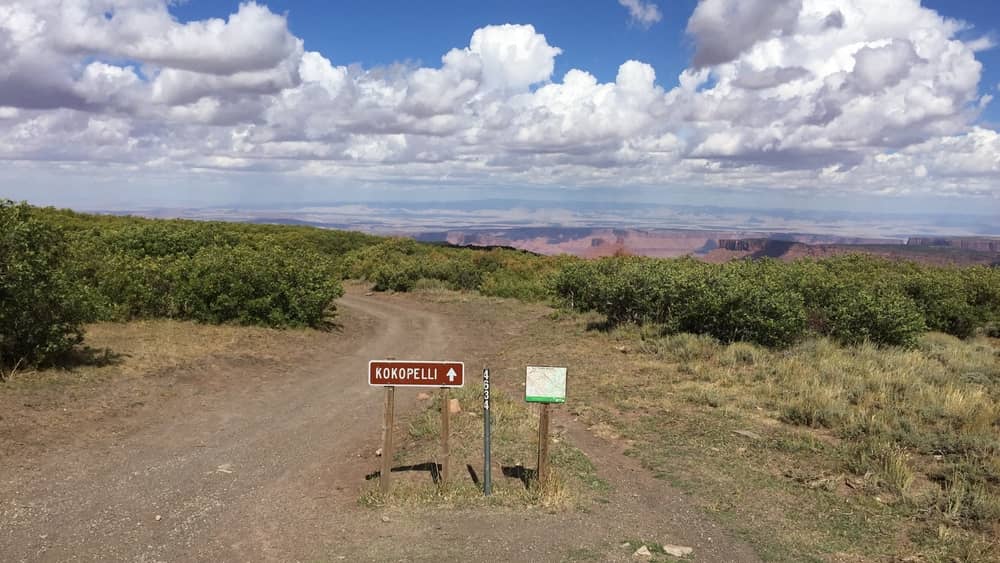
Cross Loop Road to continue down the Kokopelli, and take in the views as you head toward the southwest wall of Castle Valley and the Porcupine Rim.
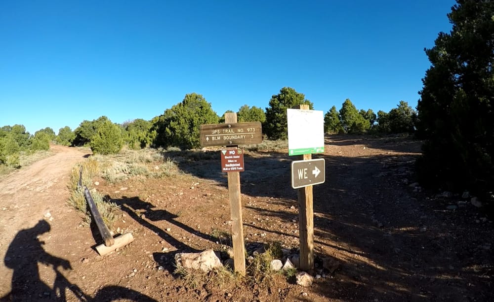
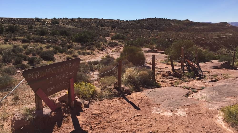
Whole Enchilada: UPS / LPS
Look for the WE signs to exit the Kokopelli and get onto Upper Porcupine Singletrack (UPS), or bail by taking the Kokopelli back to Moab. Depending on the time of year you ride, your shuttle company may drop you off here if higher points are too muddy for vehicles to get through.
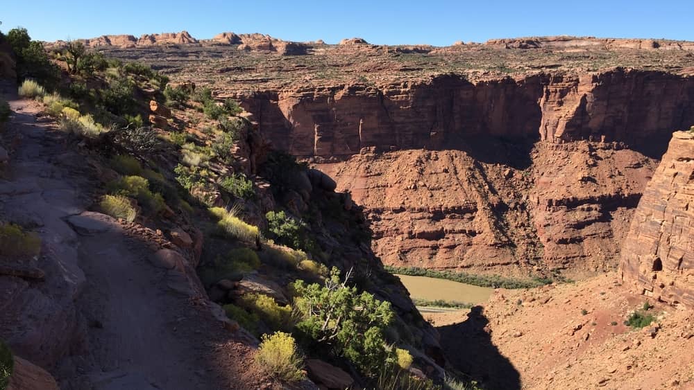
You are now on some of the best parts of the Whole Enchilada. The riding is relatively easy although there are brief technical sections including a steep pitch that is rideable, and the Notch, which isn’t for most.
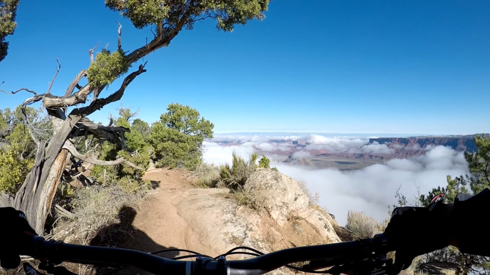
You move through the Pinyon / Juniper brush and then every so often pop out right on the cliff edge giving you a bit of a jolt. Then back into the brush, then back to the edge. It’s a huge rush.
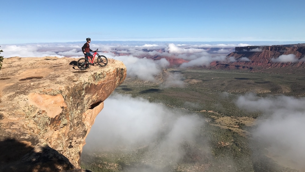
There are several spots to stop, take in the view, and get an epic photo for your Instagram feed.
Whole Enchilada: Porcupine Rim
At the end of UPS and the LPS, the Whole Enchilada trail takes a gentle left turn away from cliff edge and becomes Porcupine Rim.
If you don’t like rock gardens, you are really going to hate the top of Porcupine Rim. For miles you hop bowling ball sized rocks and 6 inch high ledges, and it can really give your upper body a shake. And it’s hard on bikes – I once taco’ed my big chain ring on a ledge and had to ride granny gear all the way back to Moab! But I love screaming down the trail dodging the rocks as the valley below opens up.
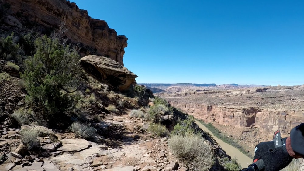
As you approach the Colorado River, the right side will fade away and you’ll be riding the cliff. The exposure isn’t as bad as Portal on Mag 7, but it’ll get the heart racing after all the doubletrack since leaving Castle Valley.
As you descend you come to the edge of Jackass Canyon.
From there you again ride cliffs down to the Colorado River, then through a cool pipe under Highway 128, and back to Moab.
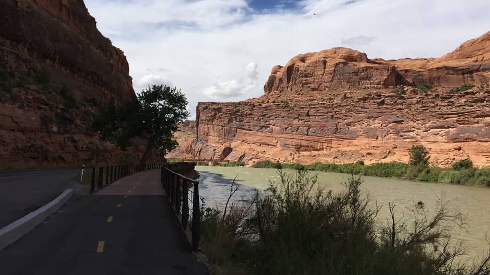
Congrats, you’ve ridden what many consider the best ride in the world.